SPUTNIK: Breaking Barriers for a Modern World
"A picture is worth a thousand words. A satellite image is worth a million dollars."
~ Sarah Parcak, American Archeologist
Sputnik launch triggered a fascination with space and development of satellite-based technology for the betterment of human life.
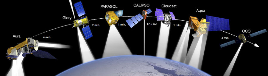
Source: NASA
Reconnaissance:
Orbital reconnaissance satellites provide vital intelligence to keep watch on enemy assets.
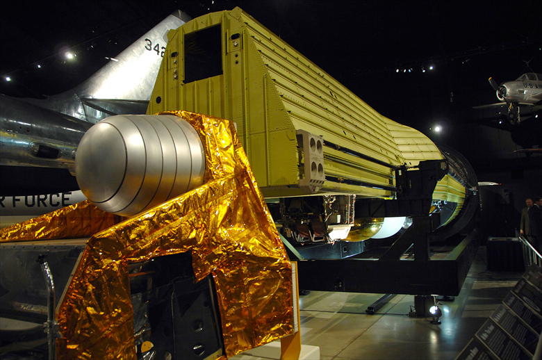
Hexagon KH-9 reconnaissance satellite. Source: National Museum of the United States Air Force.
For sustainable agriculture and smart farming, earth observation and navigation satellites provide vital input to help farmers in deciding when and how to apply resources timely.
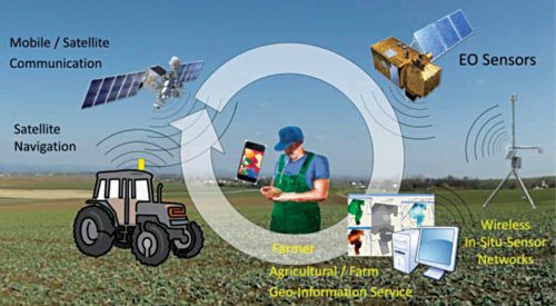
Source: Springernature
Weather:
Weather satellites are used for monitoring natural disasters (floods, forest fires, landslides, erosion) and in the fields of land use, soil sealing, spatial planning, forestry management, coastal monitoring and humanitarian aid.
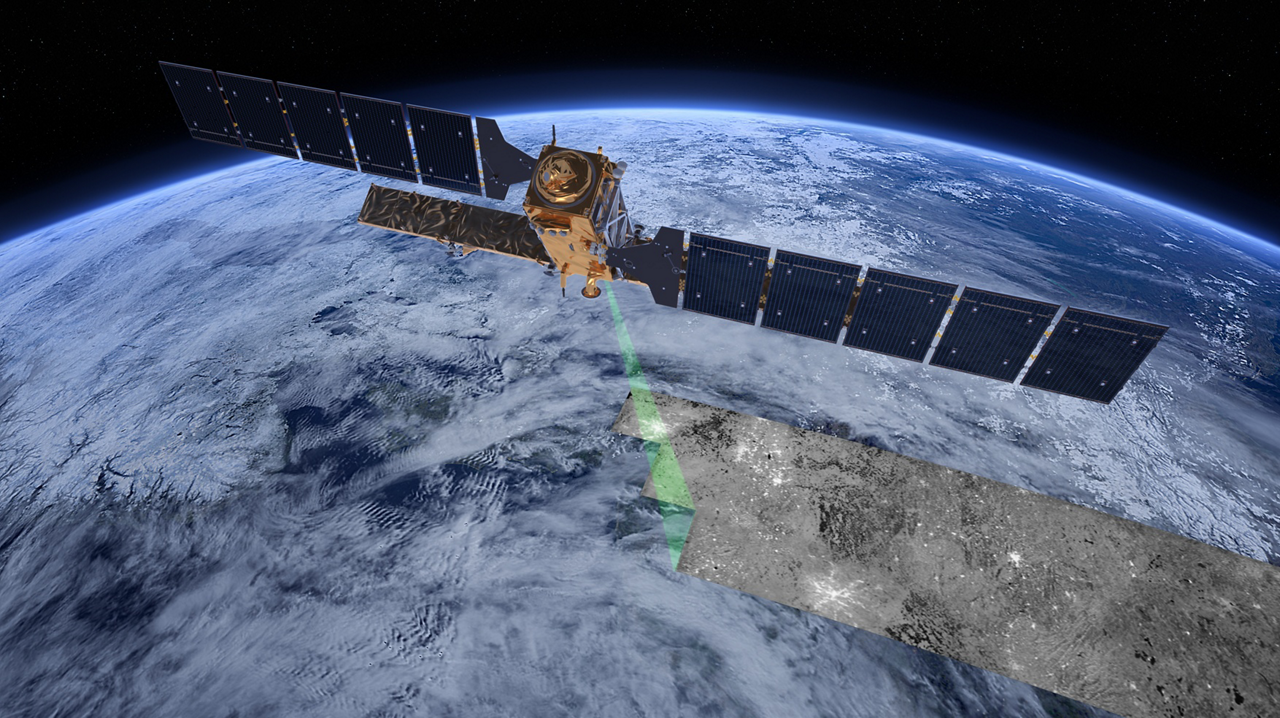
Copernicus weather satellite. Source: European Space agency
Communication:
"Satellite communications connect television screens in Japan with television cameras in England, and the distance of half a world loses its meaning."
~ Robert Kennedy
Communication satellites provide live transmission of programs such as sports and concerts.
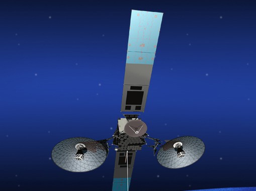
TDRS-K communication satellite. Source: NASA/Goddard Space Flight Center
Remote Sensing:
"The only technology that can 'see' beneath the ground is radar imagery. But satellite imagery also allows scientists to map short- and long-term changes to the Earth's surface. Buried archaeological remains affect the overlying vegetation, soils and even water in different ways, depending on the landscapes you're examining."
~ Sarah Parcak
Satellite imagery and other remote sensing tools expose a stunning array of forgotten sites from lost cultures.
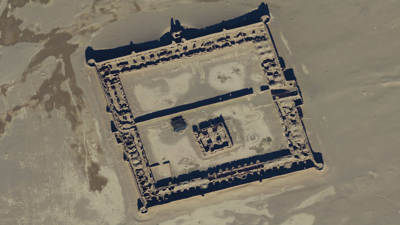
Satellite image showing 17th century caravanserai. Source: DIGITALGLOBE, INC.